
Brief by Shorts91 Newsdesk / 05:44am on 29 Aug 2025,Friday Science
NASA has shared the last image taken by Voyager 2 on August 28, 1989, captured from over 4.7 billion km away . The distant picture features Neptune prominently on the left, with its largest moon Triton visible on the right . This image marked Voyager 2’s final visual record before its optical cameras were permanently shut down to conserve power . From that vantage point, most of the sunlit sides of both bodies were oriented away from the spacecraft—offering a rare perspective as it departed the outer solar system. (PC: NASA)
Brief by Shorts91 Newsdesk / 01:20pm on 27 Aug 2025,Wednesday Science
SpaceX’s Falcon 9 rocket successfully launched and deployed satellites from Bengaluru-based Pixxel and Hyderabad’s Dhruva Space into orbit, marking a milestone for India’s private space sector. Pixxel placed three more Firefly hyperspectral imaging satellites in orbit—completing the first phase of its six-satellite constellation. These satellites capture over 135 spectral bands at 5-meter resolution across a 40-km swath, enabling advanced applications like agriculture, climate monitoring, and disaster response . Dhruva Space’s LEAP-1 satellite, carrying AI and hyperspectral payloads from Australian partners, was also deployed—signifying the startup’s first commercial mission . Industry observers hailed this dual-launch as a defining moment in the rise of Indian private space innovation.
Brief by Shorts91 Newsdesk / 04:26am on 27 Aug 2025,Wednesday Science
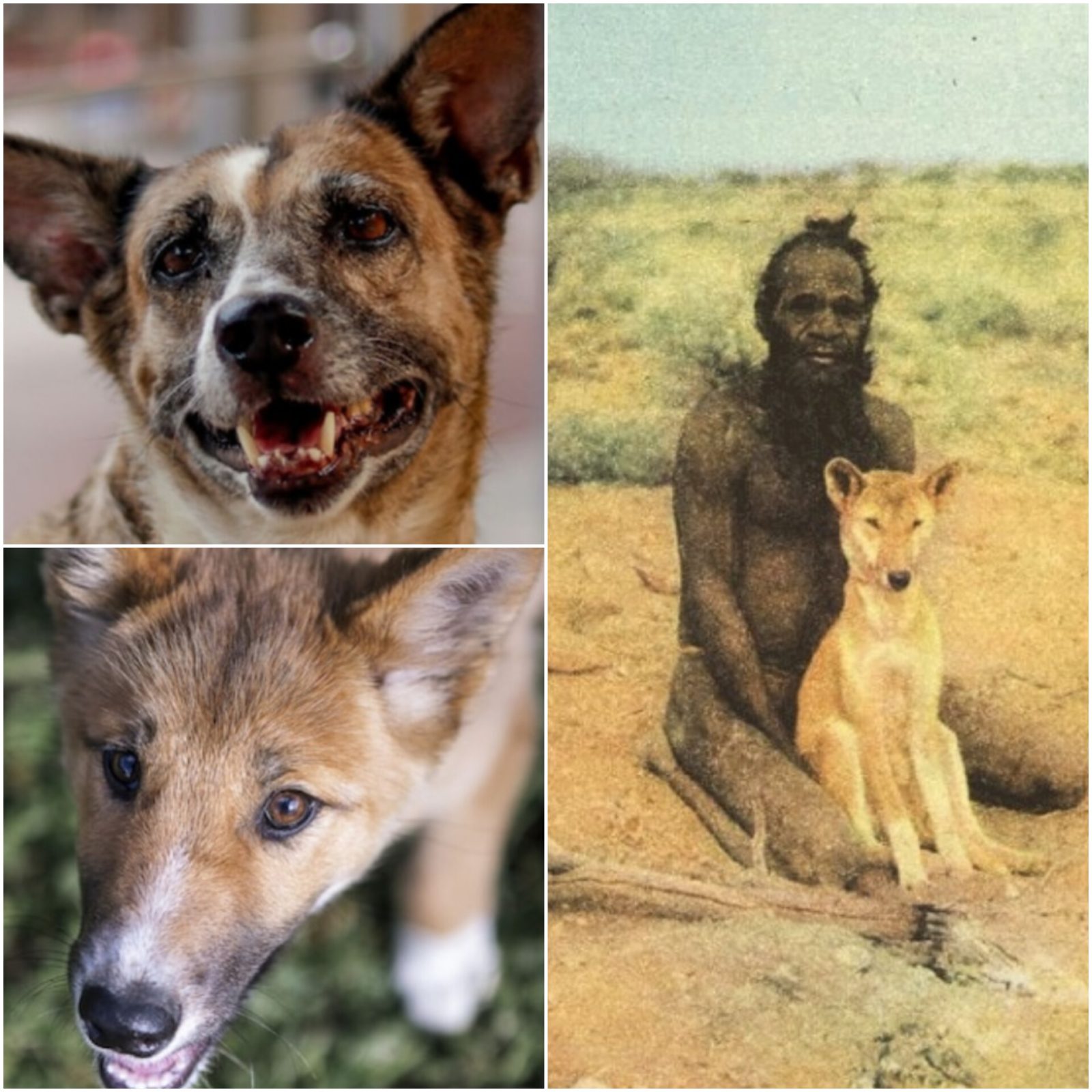
Around 4,000 years ago, India’s desi dogs travelled 7,000 kms and reached Australia. Scientists say these dogs later became the dingo, now seen as Australia’s native animal. Genetic studies show a strong link between Indian dogs and dingoes. Aboriginal people lived with dingoes, raised them, and told stories about them. Dingoes also changed Australia’s ecology as top predators. Archaeological records confirm their sudden arrival about 3,500 years ago. The desi dogs, known for their curled tails and sharp ears, survive in India even today. Their pawprints in Australia tell of a long journey from South Asia. (PC: India Today)
Brief by Shorts91 Newsdesk / 03:51am on 27 Aug 2025,Wednesday Science
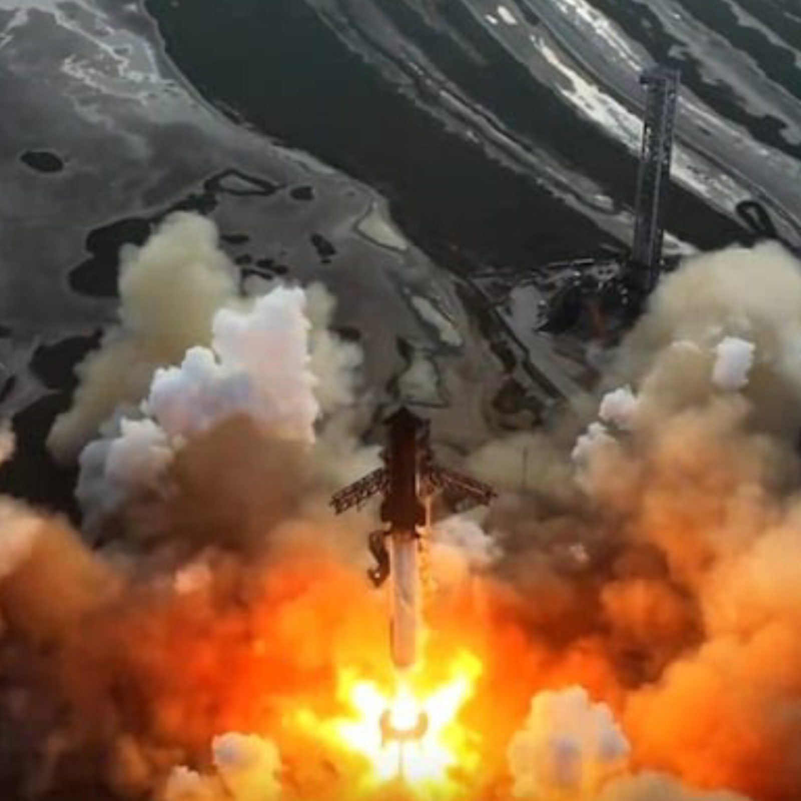
On August 26, 2025, SpaceX successfully launched its Starship-Super Heavy system from Starbase, Texas, marking the 10th full-stack test flight. The Super Heavy booster performed controlled burns before splashing into the Gulf of Mexico, while Starship entered orbit and deployed eight dummy satellites—a first for the program. The vehicle also conducted an in-space Raptor engine relight test before reentry. Starship reentered Earth’s atmosphere and splashed into the Indian Ocean, sustaining some damage but achieving mission goals. The test showcased significant progress toward reusable spacecraft, advancing SpaceX’s ambitions for Moon, Mars, and Starlink missions. (PC: SpaceX)
Brief by Shorts91 Newsdesk / 09:49am on 26 Aug 2025,Tuesday Science
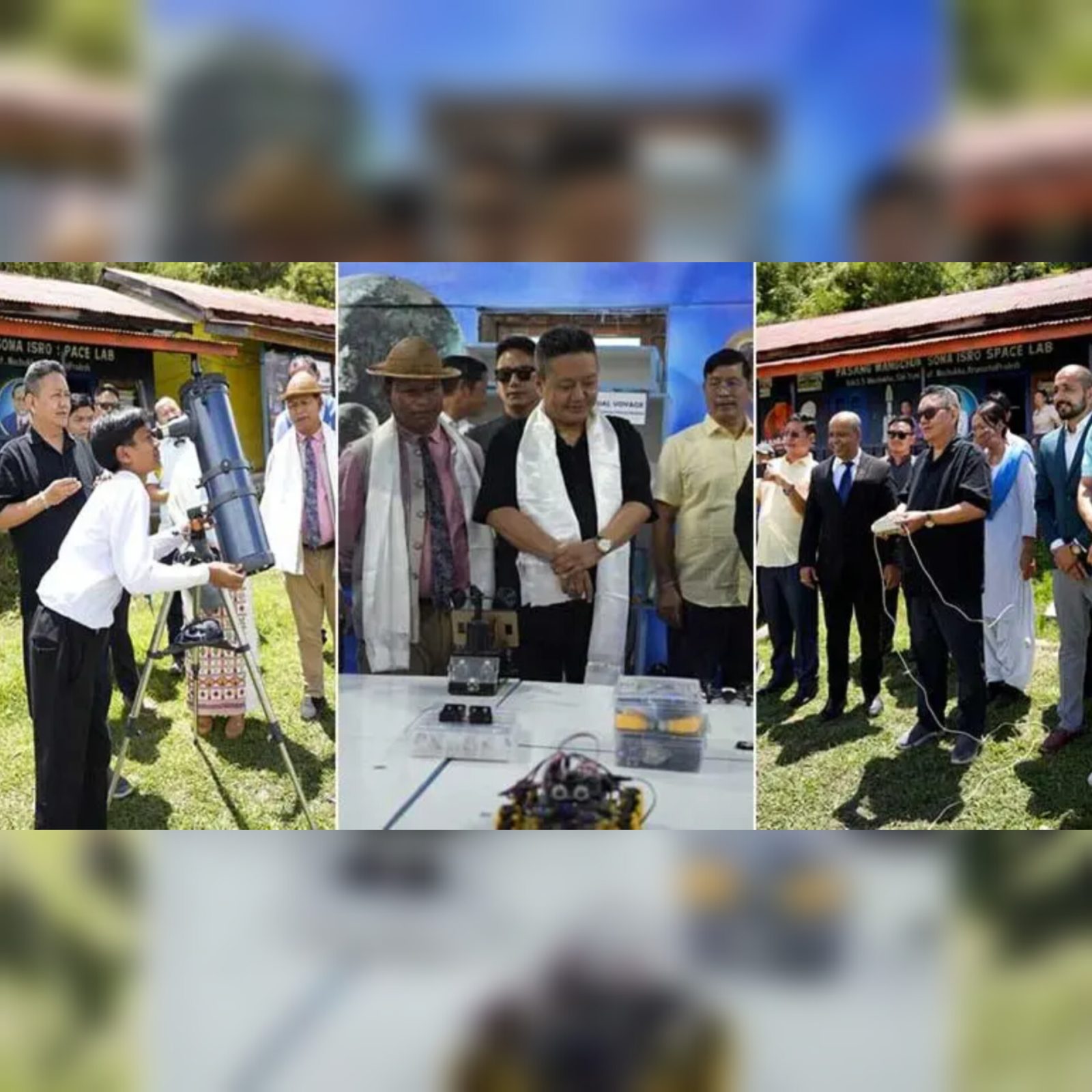
Arunachal Pradesh Education Minister Pasang Dorjee Sona inaugurated the Pasang Wangchuk Sona ISRO Space Laboratory on August 16, 2025, at Mechuka Government Higher Secondary School in Shi-Yomi district—co-developed by ISRO and the Muskaan Foundation. Named in honour of the minister’s late father, the facility aims to offer hands-on learning in space science and technology, inspiring innovation, critical thinking, and scientific ambition among students . Sona expressed this is more than an educational facility—it's a heartfelt tribute and a beacon for youth in his region to “dream bigger, explore science fearlessly, and reach for the stars”.
Brief by Shorts91 NewsDesk / 06:20am on 25 Aug 2025,Monday Science
Group Captain Shubhanshu Shukla, the first Indian to set foot on the International Space Station (ISS), received a hero’s welcome in Lucknow after completing the Axiom-4 mission. Returning from nearly 20 days in orbit, Shukla was greeted at Lucknow Airport by cheering crowds, family, and Deputy CM Brajesh Pathak. A felicitation ceremony was held at City Montessori School, attended by top state leaders. Defence Minister Rajnath Singh honored Shukla and his fellow astronauts, praising their role in India’s space ambitions. Shukla called the mission a “big achievement” and emphasized its importance for future goals like Gaganyaan, Bharatiya Antariksh Station, and India’s eventual lunar landing.
Brief by Shorts91 Newsdesk / 06:48pm on 24 Aug 2025,Sunday Science
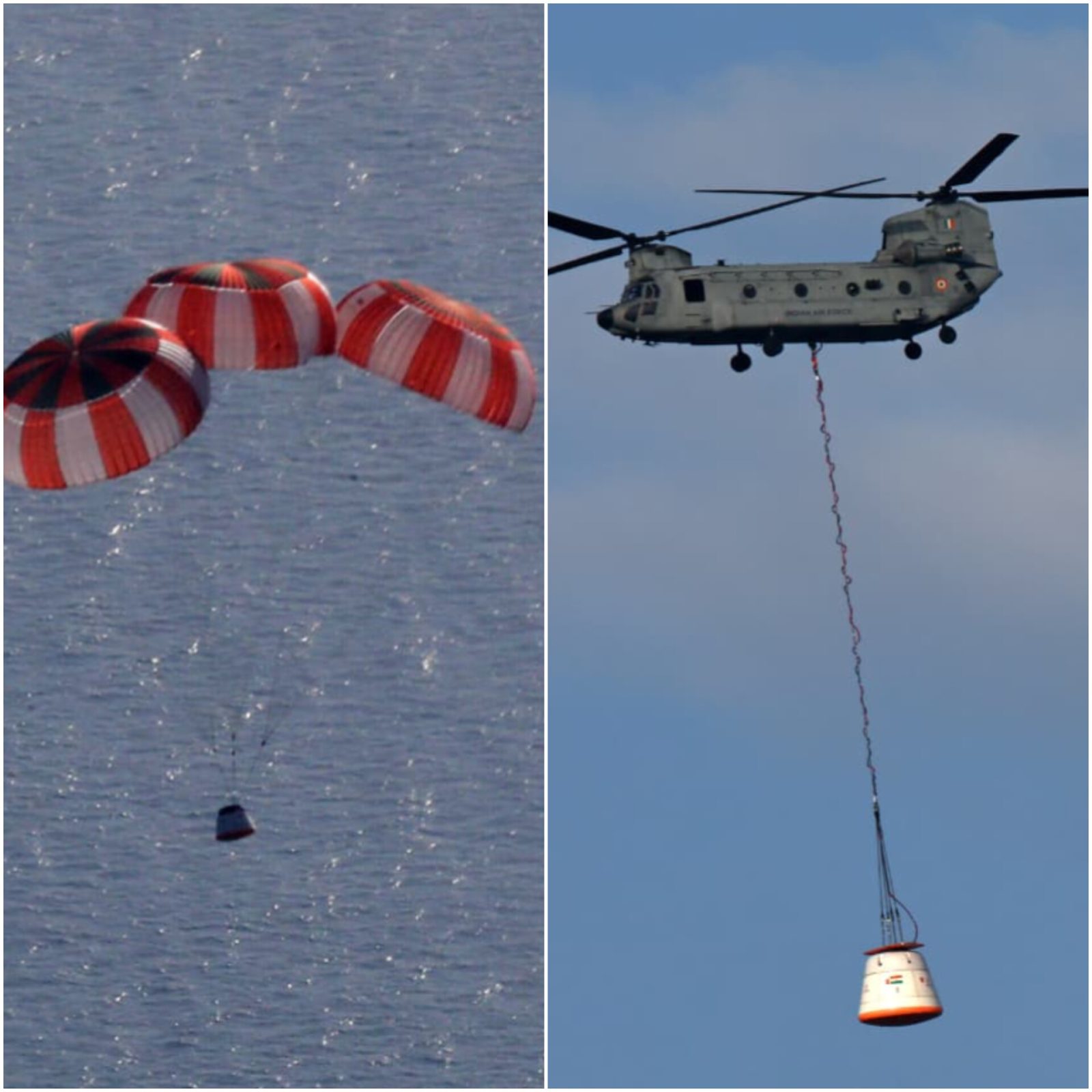
The Indian Space Research Organisation (ISRO) has successfully carried out its first Integrated Air Drop Test (IADT-01) for the Gaganyaan mission. The test demonstrated the parachute-based deceleration system, ensuring astronaut safety during re-entry. It was conducted with support from the Indian Air Force, DRDO, Indian Navy, and Coast Guard. ISRO chairman V Narayanan confirmed that the first uncrewed Gaganyaan flight, G1, will launch in December with the humanoid robot Vyommitra. India plans its first crewed flight in 2027. Future missions include Chandrayaan-4 in 2028, a Venus mission, a space station by 2035, and a Moon landing by 2040. (PC: X)
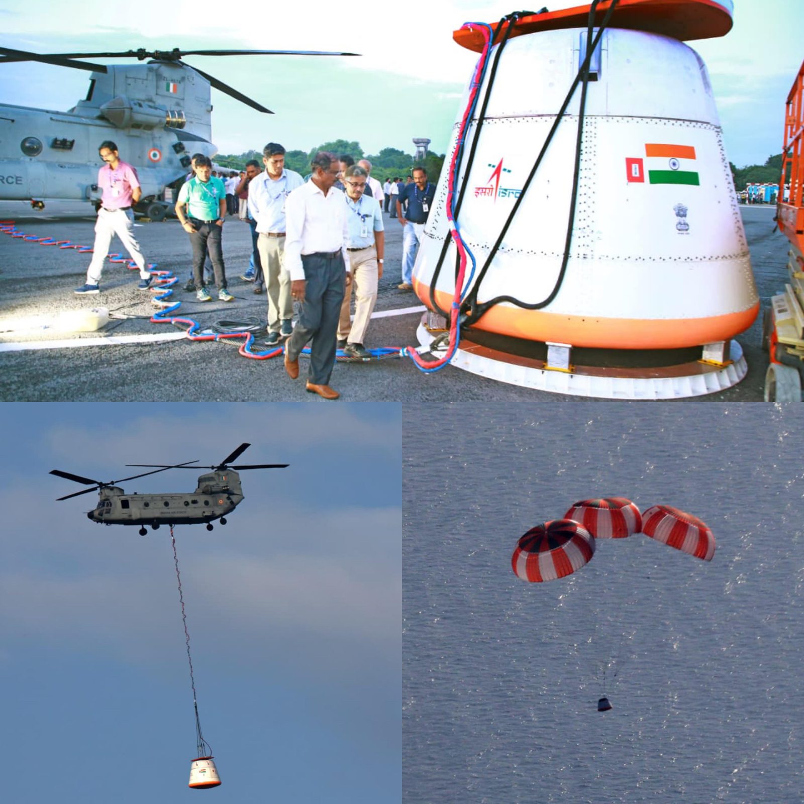
Brief by Shorts91 NewsDesk / 09:48am on 24 Aug 2025,Sunday Science
ISRO has successfully conducted its first Integrated Air Drop Test (IADT-01) for the Gaganyaan mission’s parachute-based deceleration system, marking a major milestone in astronaut safety validation. The test was a joint effort involving the Indian Air Force, DRDO, Indian Navy, and Coast Guard. ISRO Chairman V. Narayanan confirmed that the uncrewed Gaganyaan-1 flight, featuring the half-humanoid Vyommitra, is scheduled for December 2025. With 80% of over 10,000 tests completed, the remaining are expected by March 2026. Union Minister Jitendra Singh outlined progress on launch vehicles, crew modules, and recovery infrastructure. India aims for a crewed Gaganyaan flight by 2027 and a Moon landing by 2040. (PC: ISRO)
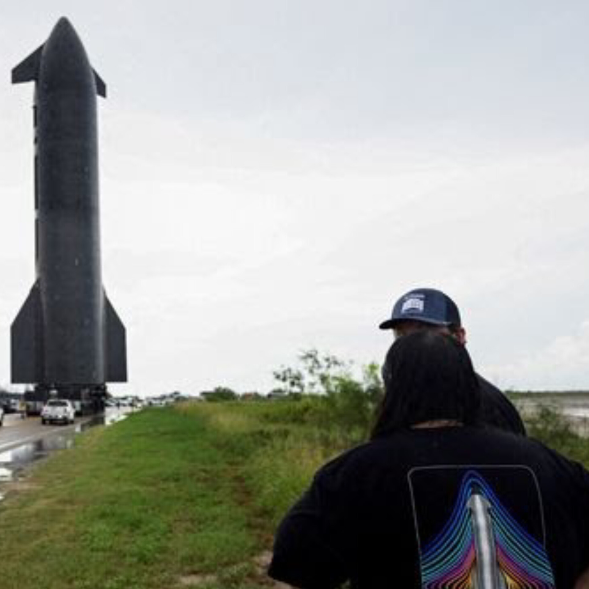
Brief by Shorts91 Newsdesk / 08:16am on 24 Aug 2025,Sunday Science
Elon Musk’s SpaceX is gearing up for the tenth test flight of its colossal Starship rocket this Sunday from its Starbase facility in Texas—a venture now deemed a pivotal inflection point amid multiple recent failures . In 2025, three consecutive Starship flights ended in dramatic explosions—twice mid-air and once during a ground test—raising serious concerns over the program’s viability . SpaceX has made technical corrections, including redesigning a fuel diffuser, to address the root cause of instability . Experts warn the outcome could either propel Starship toward success or signal a major setback in SpaceX’s Mars ambitions. (PC: Reuters)
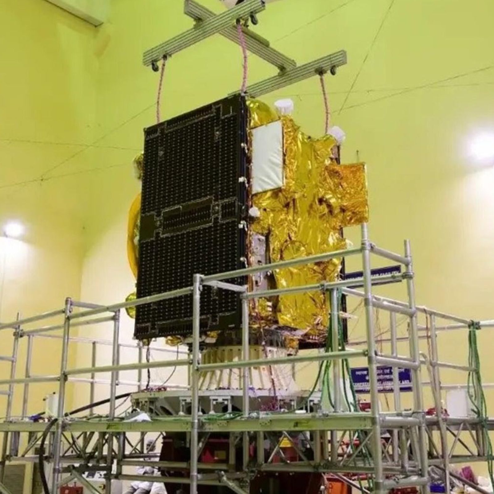
Brief by Shorts91 Newsdesk / 07:20pm on 23 Aug 2025,Saturday Science
India’s regional satellite navigation system, NavIC, is facing delays in replacing its aging satellites due to setbacks in developing reliable indigenous atomic clocks. Earlier, multiple imported rubidium clocks onboard first-generation satellites malfunctioned, prompting efforts to create homegrown alternatives. However, the transition to these indigenous clocks has taken longer than expected, stalling the deployment of next-generation NavIC satellites. This delay constrains India’s ability to bolster the navigation constellation and maintain uninterrupted services, underscoring the critical need for timely development of essential satellite technologies. (PC: ISRO)