Brief by Shorts91 Newsdesk / 03:17am on 08 Aug 2025,Friday Weather & Environment
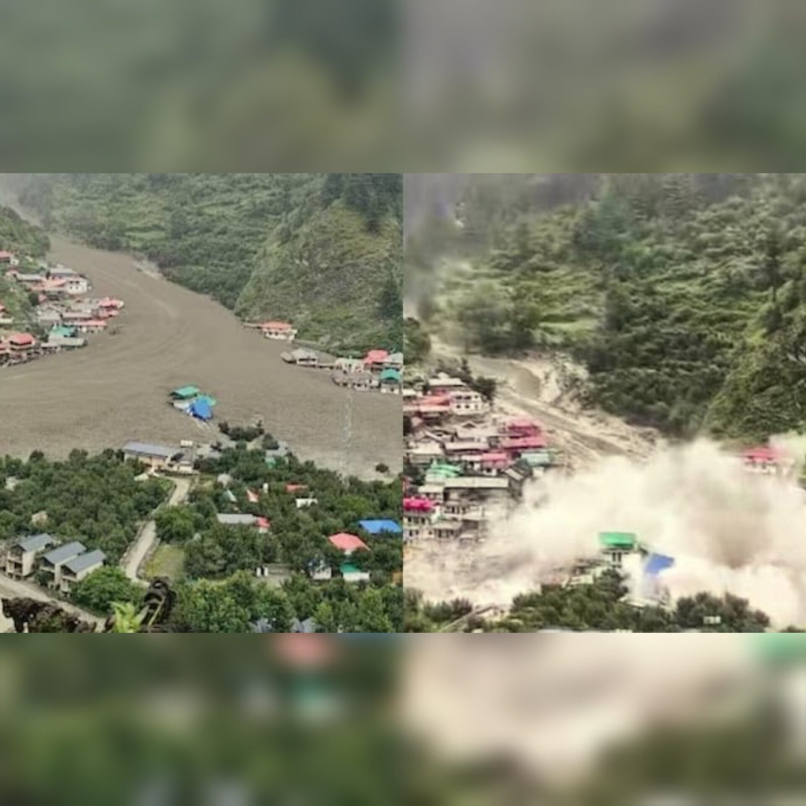
ISRO’s very high-resolution satellite imagery captured the dramatic aftermath of the devastating flash floods in Uttarkashi’s Dharali village. The images reveal vast changes in river pathways and show a 20-hectare area buried beneath sediment and debris, with many structures destroyed or submerged under mud and water . Initial assessments pointed to a cloudburst, but recent expert analyses now suggest a glacier collapse or glacial lake outburst as the more probable triggers. (PC: India Today)