Brief by Shorts91 Newsdesk / 01:52pm on 08 Aug 2025,Friday Weather & Environment
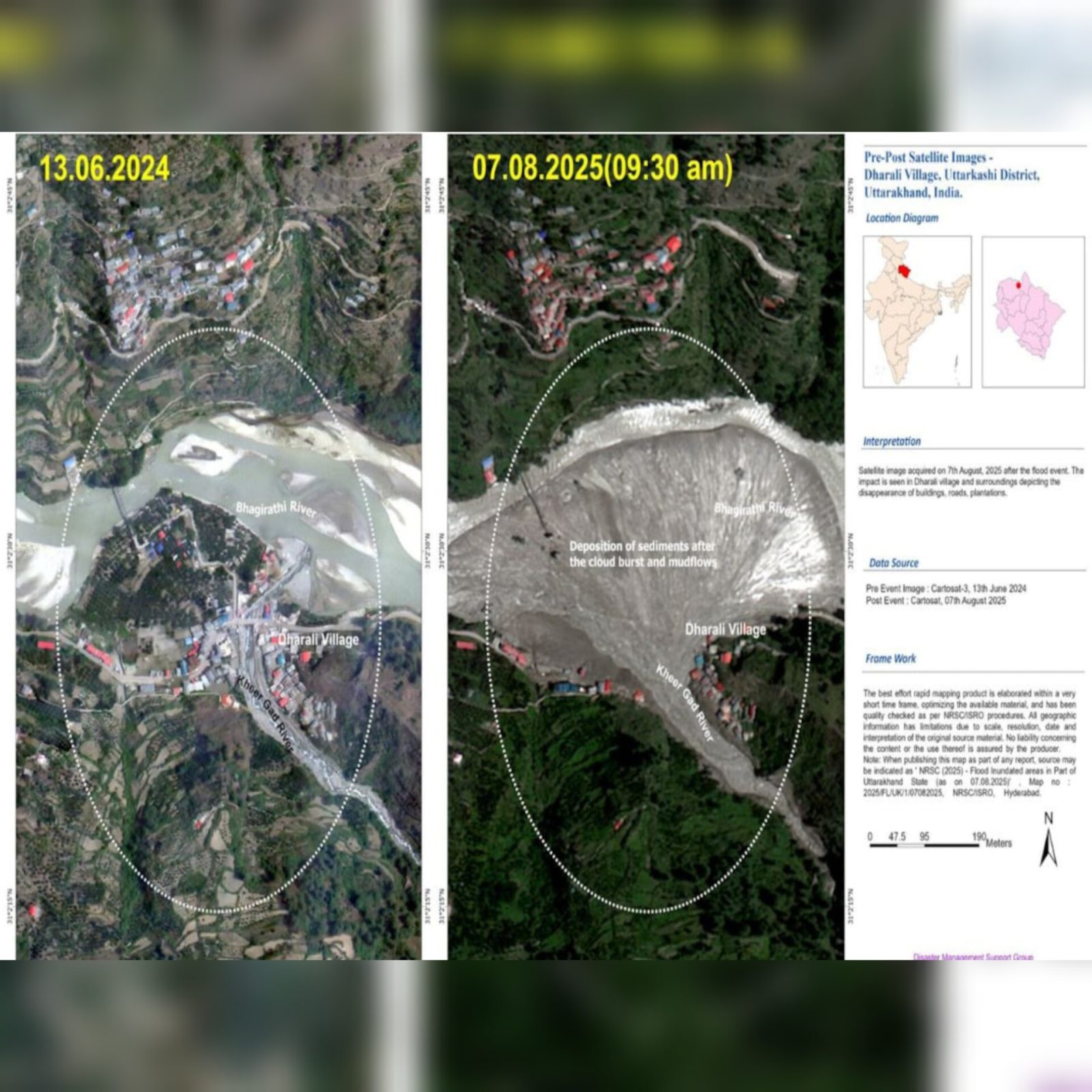
ISRO has released before-and-after satellite images showing extensive damage caused by recent flash floods in Dharali village, Uttarkashi, Uttarakhand. Triggered by intense rainfall, the floods have led to massive soil erosion, destruction of agricultural land, and infrastructure damage, including washed-away roads and houses. The Indian space agency's high-resolution Cartosat-3 satellite captured clear visual evidence of the landscape transformation. These images are aiding disaster response and recovery efforts by state and national agencies. Authorities are conducting rescue operations, while environmentalists raise concerns over the increasing frequency of such disasters due to climate change and unchecked development.