Brief by Shorts91 Newsdesk / 04:42am on 09 Aug 2025,Saturday Weather & Environment
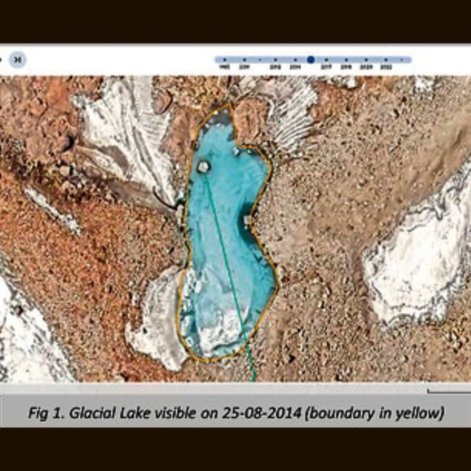
The National Institute of Disaster Management (NIDM) identified a glacial lake upstream of Kheer Ganga in satellite images from 2014, 2020, and twice in 2022, measuring roughly 0.82 hectares and perched around 5,200 meters altitude . The lake’s position and drainage suggest hydrological links to Dharali, feeding flash floods down Kheer Ganga . While this supports glaciologists’ hypothesis that a glacial lake outburst flood (GLOF) could have triggered the devastating mudslide, NIDM emphasized that confirmation requires high-resolution imaging, field surveys, and hydrological modeling. (PC: HT File)