Brief by Shorts91 Newsdesk / 05:38pm on 10 Mar 2026,Tuesday International
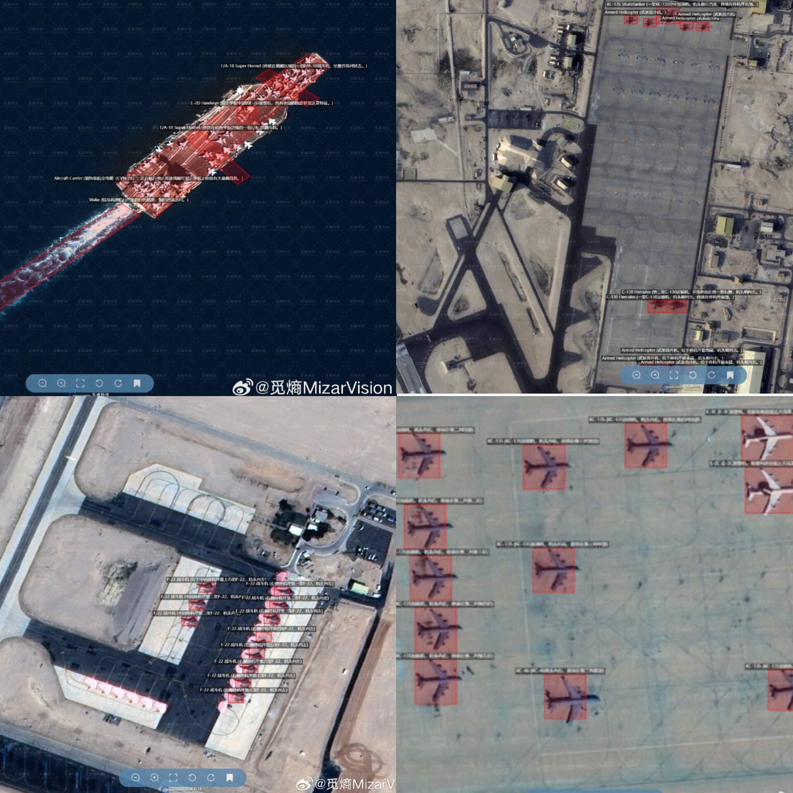
During the ongoing Iran–Israel conflict, a Chinese intelligence analysis firm, MizarVision, has been monitoring U.S. military deployments in the Middle East using satellite imagery and artificial intelligence. The firm published detailed images showing U.S. fighter jets, surveillance aircraft, and military infrastructure at bases in countries such as Saudi Arabia, Qatar, Jordan, and Israel. It also tracked American aircraft carriers like the USS Gerald R. Ford and USS Abraham Lincoln from space. The data combines commercial satellite images with aircraft and ship tracking systems, allowing near real-time monitoring of military assets. Although there is no proof Iran used the information for attacks, several locations previously highlighted were later targeted during strikes. (PC: NDTV)
